This article contains affiliate links. If you book through them, I earn a small commission at no extra cost to you.
In This Article
- Mt. Asahidake — Hokkaido’s Highest Point
- Sounkyo Gorge — Dramatic Scenery, Tired Town
- Ginga and Ryusei Waterfalls
- The Town Itself
- Kurodake — The Other Ropeway
- The Grand Traverse — For Serious Hikers Only
- When to Visit — Timing Is Everything
- Autumn Foliage (Late August to Early October)
- Summer (June to August)
- Winter (December to April)
- Spring (May to June)
- Tenninkyo Onsen — The Quiet Alternative
- How to Get There
- From Asahikawa
- From Sapporo
- Getting Around the Park
- Where to Stay
- Asahidake Side
- Sounkyo Side
- Asahikawa as a Base
- Practical Details
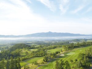
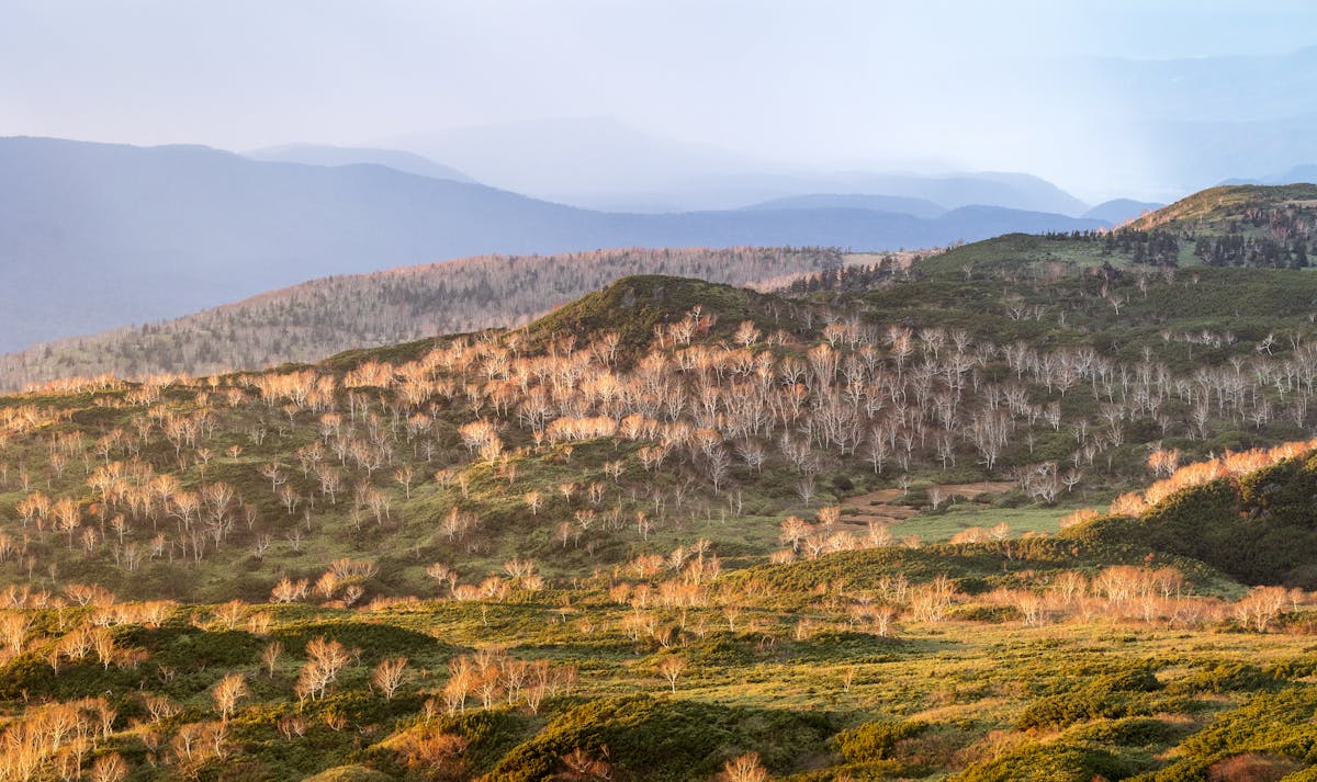
I stepped off the Asahidake Ropeway into a wall of cold fog, and for about ten seconds I honestly thought I’d made a mistake coming up. Then the cloud shifted, and the entire volcanic plateau opened up below me — steaming fumaroles, rust-red earth, and a carpet of autumn color stretching to the horizon. That was September. In most of Japan, autumn doesn’t even start until November. Up here in Daisetsuzan, the seasons run on their own schedule.
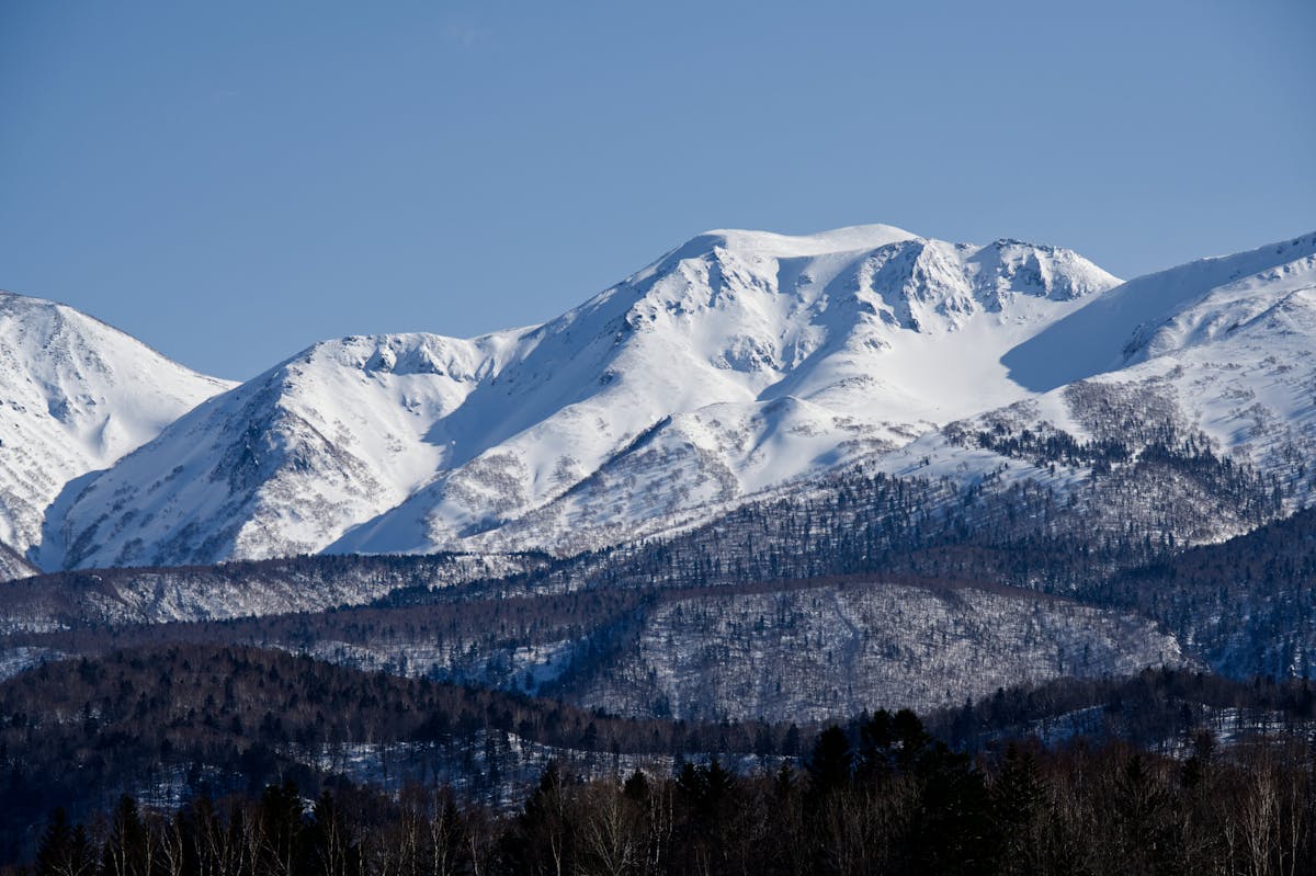
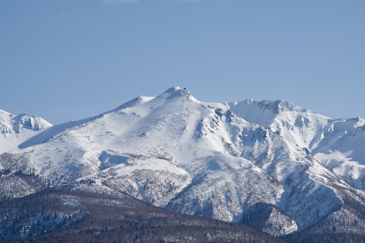
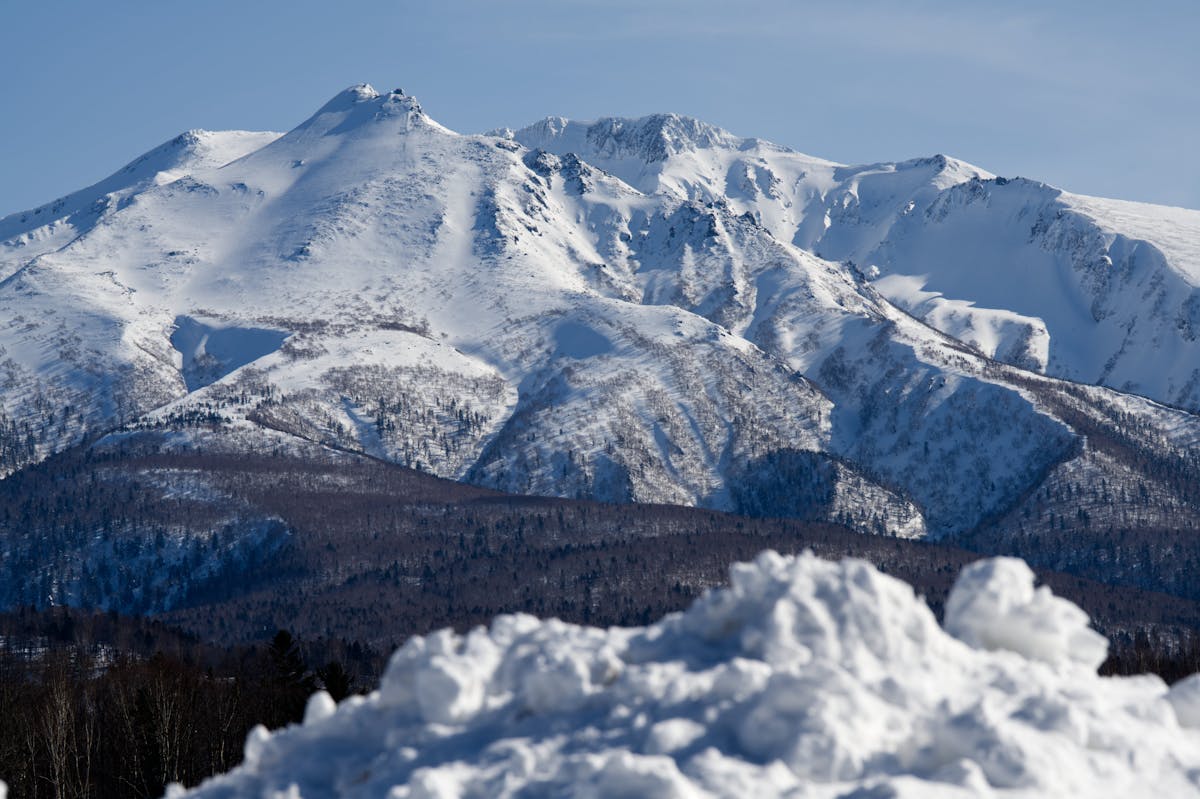
Daisetsuzan National Park is Japan’s largest national park at roughly 2,268 square kilometers — bigger than some of Japan’s prefectures. The name translates to “Big Snow Mountains,” and that’s not hyperbole. Mt. Asahidake, the park’s highest peak at 2,291m, is typically the first place in Japan to see snowfall each autumn and the last to lose it in spring. But the park isn’t just about snow. It’s volcanic plateaus, deep gorges, wild onsen, and some of the best multi-day hiking in the country.
Most visitors base themselves in either Sounkyo Onsen on the eastern side or Asahidake Onsen on the western side. They’re completely different experiences, and which one you pick matters more than you’d think. I’ll break down both, plus everything you actually need to know about getting here, hiking, and timing your visit.
Mt. Asahidake — Hokkaido’s Highest Point
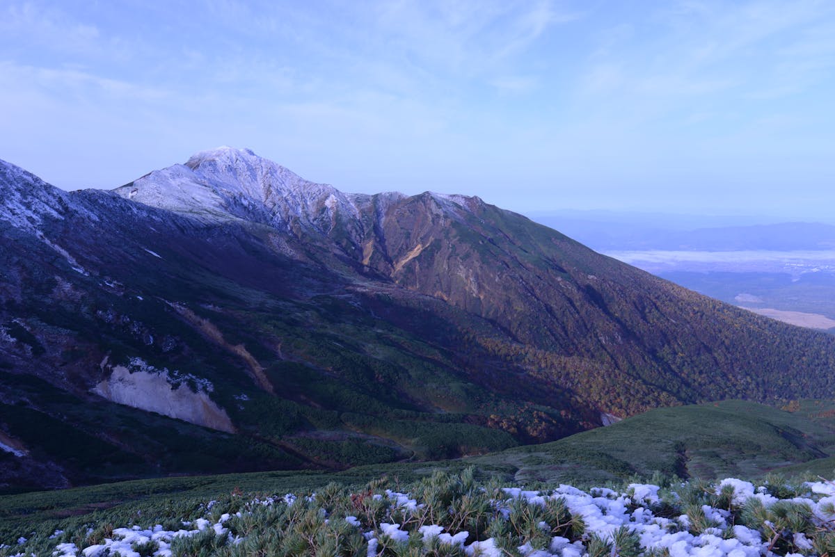
Asahidake is the main event for most people, and for good reason. At 2,291 meters, it’s not just the highest peak in Daisetsuzan — it’s the highest point in all of Hokkaido. And unlike many of Japan’s famous peaks, you don’t need to be an experienced mountaineer to experience it. The Asahidake Ropeway does the heavy lifting, carrying you from 1,100m to 1,600m in about ten minutes.
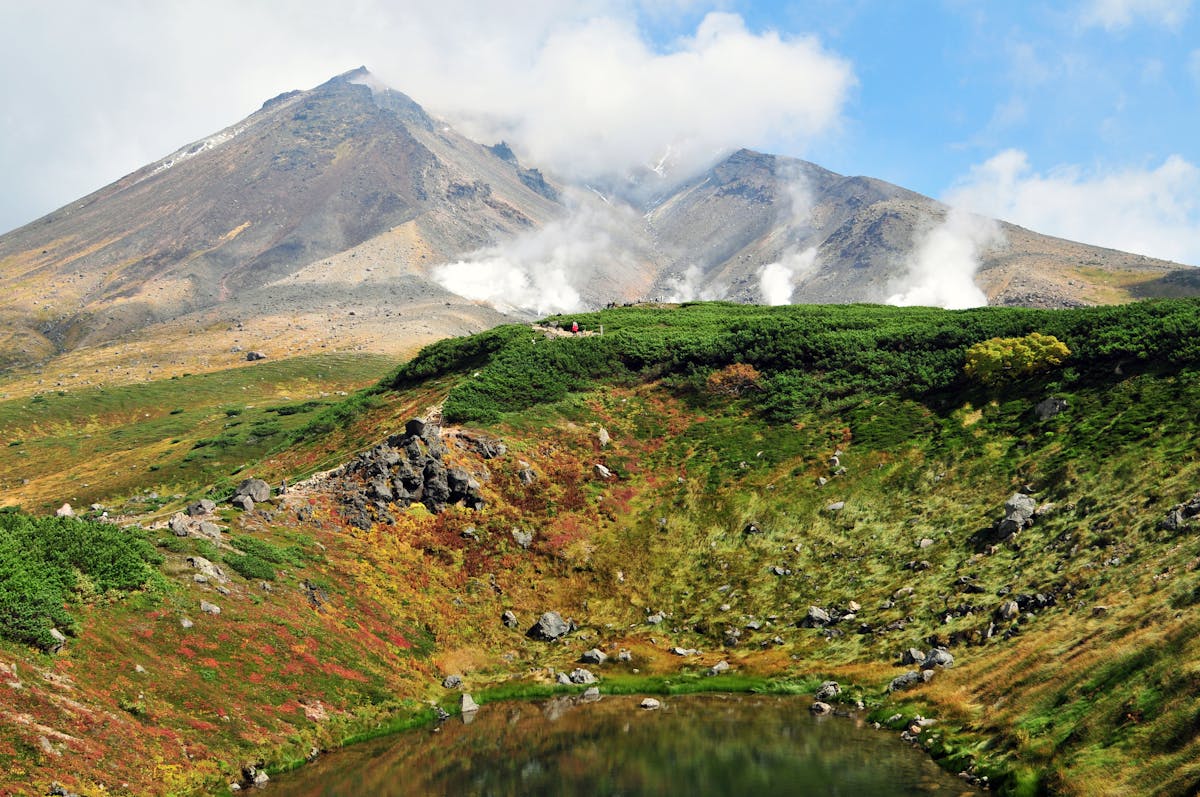
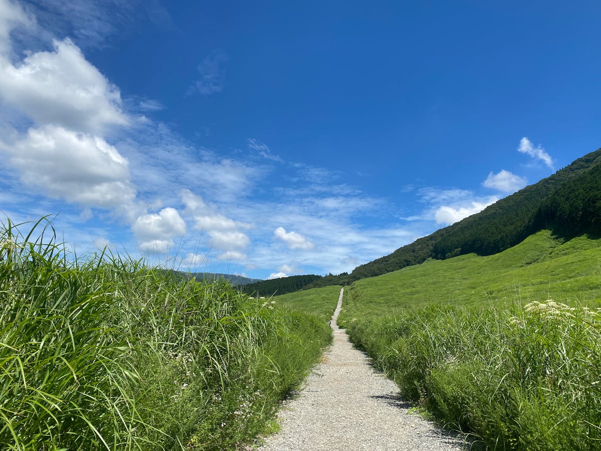
From the upper ropeway station at Sugatami, you’ve got options. The easiest is the Sugatami Pond circuit — a 1.7km loop trail that takes about an hour and passes through an active geothermal area with steam vents (called fumaroles) hissing out of the ground. On a clear day, you can see the volcanic crater lake and the surrounding peaks. This trail is boardwalked and mostly flat, so it works even if you’re not a hiker.
For the summit, budget 4 to 5 hours round trip from the ropeway station. The trail is well-marked but steep in places, and the final push to the top is loose volcanic rock. The weather changes fast up here — I’ve talked to people who started in sunshine and hit near-zero visibility within an hour. Bring layers. Bring rain gear. And check the forecast before you go, because mountain weather forecasts for Asahidake are genuinely useful and available at the ropeway station.
One thing the ropeway website won’t tell you: the parking lot at the base fills up on autumn weekends, especially late September. If you’re driving a rental car, arrive before 8am or expect to circle for a spot.
Sounkyo Gorge — Dramatic Scenery, Tired Town
I’ll be straight with you about Sounkyo. The gorge itself — the towering cliffs, the waterfalls, the raw geology of the place — is genuinely spectacular. The onsen town at the base of it? That’s another story.
Sounkyo Gorge runs through the eastern side of the park, carved by volcanic activity and the Ishikari River over millennia. The cliff walls rise up to 200 meters in places, and in autumn the rock faces are streaked with red and orange where the maples and birch have taken hold in the crevices. It’s a dramatic landscape, no question.
Ginga and Ryusei Waterfalls
The two star waterfalls of Sounkyo are Ginga Falls (Silver River) and Ryusei Falls (Shooting Star), both dropping about 120 meters down the gorge walls. They’re roughly 5 minutes apart by car and you can view both from a dedicated observation platform that involves a steep 20-minute uphill walk. Honestly, the walk itself is half the experience — you wind through forest and get progressively better angles on both falls as you climb.
Both waterfalls are included in Japan’s top 100 waterfalls list, and they’re at their best after rain when the flow picks up. In autumn, the surrounding trees frame them beautifully. In winter, parts of both falls freeze into spectacular ice columns, which feeds into the annual Sounkyo Ice Festival (more on that below).
The Town Itself
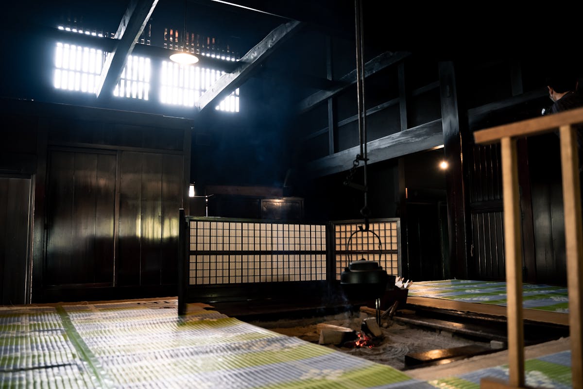
Now for the honest part. Sounkyo Onsen town is, well, a bit past its prime. The main strip has a handful of large resort-style hotels that were clearly built during Japan’s bubble era, and some of them show their age. It’s not ugly exactly, but if you’re picturing a charming little hot spring village like Noboribetsu or Jozankei, adjust your expectations. The town exists to serve the national park, and it does that job — but don’t expect much in the way of restaurants or evening atmosphere outside the hotels.
That said, the onsen water here is legitimately good. The hot springs are sodium chloride and sulfate springs, good for sore muscles after hiking. Most of the big hotels allow day bathing for around ¥800-¥1,500, and some have outdoor baths (rotenburo) with views of the gorge walls. Kurodake-no-Yu is the public bath in town and a reliable option if you don’t want to deal with a hotel lobby.
Kurodake — The Other Ropeway
Less famous than Asahidake but equally worth your time. The Kurodake Ropeway lifts you from Sounkyo town up to the 5th station of Mt. Kurodake in 7 minutes, and from there a pair-lift (two-person chairlift) takes you higher still. The views from the ropeway over the gorge are excellent, especially in autumn when the ravine below is a patchwork of gold and crimson.
From the top of the chairlift, you can hike to the Kurodake summit (1,984m) in about 1 to 1.5 hours. It’s steeper than the Asahidake ropeway trail but shorter. From the summit, the view opens up to the Ohachidaira caldera — a massive volcanic crater that connects Kurodake to Asahidake. This is also where the Grand Traverse route passes through, so on summer days you’ll spot through-hikers with full packs heading across the plateau.
A practical note: the chairlift section doesn’t run in bad weather, and in early season (June) there’s often still significant snow above the chairlift station. Don’t attempt the summit without proper footwear unless it’s high summer.
The Grand Traverse — For Serious Hikers Only
If you’ve come across the Daisetsuzan Grand Traverse online, you already know it’s one of Japan’s legendary long-distance hikes. The route runs roughly 60-80 kilometers along the spine of the Daisetsuzan range, typically from Asahidake or Kurodake in the north to Furanodake in the south, crossing the volcanic plateau and several peaks over 2,000 meters.
Most hikers take 3 to 5 days depending on fitness, weather, and how many peaks they bag along the way. The route passes through Ohachidaira caldera, over Hokuchin-dake (2,244m), along the knife-edge ridge connecting Pippu-dake and Antaroma-dake, and eventually down through Tokachi-dake to the hot springs at the southern end.
There’s a purist’s debate about what counts as a “full” traverse. The Daisetsuzan National Park Council defines it as Asahidake or Kurodake to Furanodake — about 68 kilometers. But some local guides argue the true Grand Traverse runs from Genshigahara to Aizankei Onsen, which adds the northern ridgeline section that most people skip. Pro skimo racer Ken Fujikawa set the speed record on the Furanodake-to-Asahidake route at 13 hours and 21 minutes. In May. On skis. So maybe don’t use his time as a benchmark.
This is not a beginner hike. You’re above the treeline for long stretches, exposed to weather that can turn deadly fast. The Hokkaido hiking guide has more on what to prepare, but the short version: you need proper gear, experience with multi-day alpine hiking, current weather forecasts, and a realistic assessment of your fitness. Mountain huts along the route are basic — think plywood shelters, no food service, no reservations. Bring your own everything.
When to Visit — Timing Is Everything
Daisetsuzan’s seasons are more extreme and earlier than the rest of Hokkaido, which is itself earlier than mainland Japan. Getting the timing right makes a huge difference.
Autumn Foliage (Late August to Early October)
This is the big one. Daisetsuzan sees Japan’s earliest autumn color — the alpine zones around Asahidake and Kurodake start turning in late August, weeks before anywhere else in the country. Peak color at the summit level is usually mid to late September, working its way down to the gorge level by early to mid October. If you’re planning a Hokkaido autumn trip, this is where it starts.
The contrast in October is wild — snow on the peaks, red and gold on the mid-slopes, and green still hanging on at the base. You can see three seasons in one view. October weekends at the Asahidake Ropeway are extremely busy though. Weekdays are better if you can swing it.
Summer (June to August)
The hiking season. Snow typically clears from the main trails by late June, and summer in Hokkaido brings wildflowers to the alpine meadows. July is peak bloom. Temperatures at the summit level stay cool — high of maybe 21 degrees Celsius in August, dropping to 6 at night. Down in Sounkyo town it’s warmer but still pleasant compared to the sweltering mainland.
Bug warning: the valleys can get bad with mosquitoes and biting flies in July. Bring repellent, especially on the lower forest trails.
Winter (December to April)
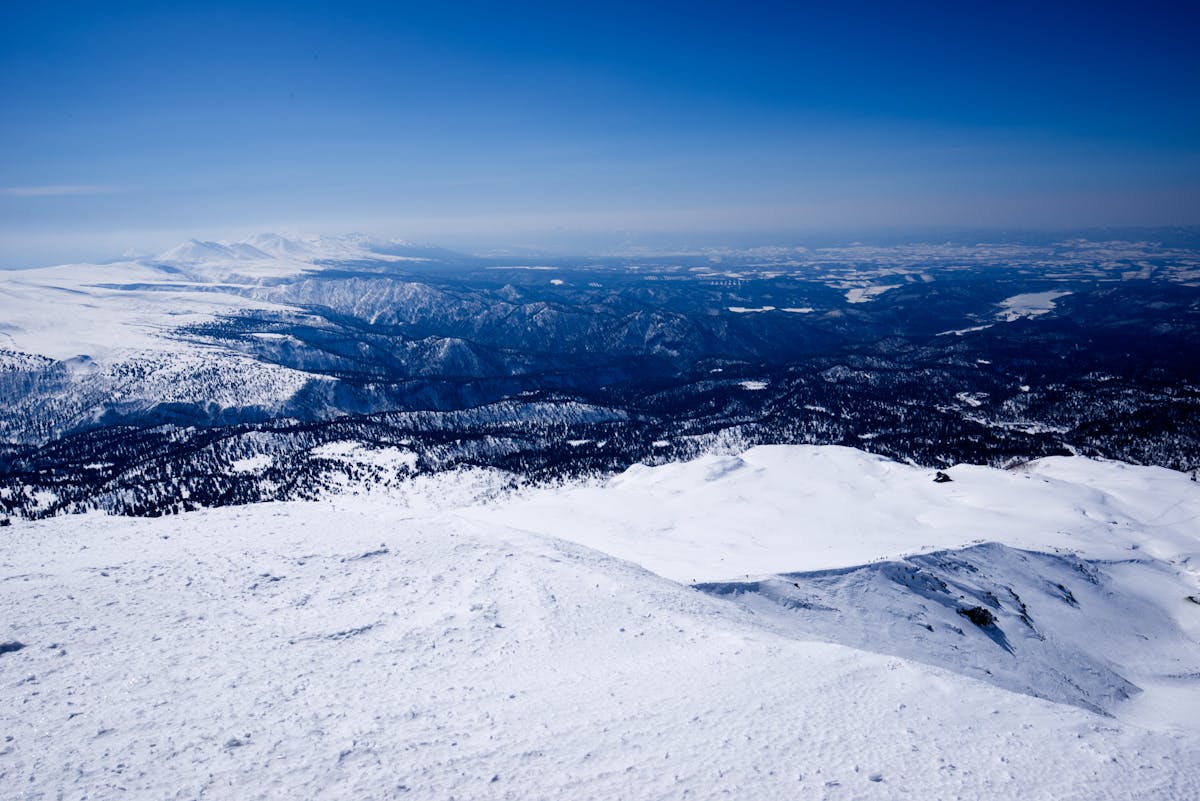
The park gets absolutely buried. We’re talking meters of snow, not centimeters. Most roads close, including the route between Sounkyo and Asahidake. The Asahidake Ropeway runs a limited winter schedule for backcountry skiers and snowshoers, and the terrain up top is serious — this is ungroomed, unpatrolled wilderness skiing in potentially extreme conditions.
The Sounkyo Ice Festival (Sounkyo Hyobaku Matsuri) runs from late January to mid-March and is worth a visit if you’re in the area. They build ice structures illuminated with colored lights along the Ishikari River, and on weekends there are fireworks. It’s smaller and less polished than the Sapporo Snow Festival but more atmospheric in its own way — you’re standing in a frozen gorge, not a city park.
Spring (May to June)
Misleading name. “Spring” in the Daisetsuzan means deep snow still covering most of the landscape through May. Cherry blossoms might be out down in Asahikawa, but up in the mountains it’s effectively winter with different calendar dates. The Asahidake area typically doesn’t see bare ground until late June. Serious spring skiers love this period, but hikers should wait until July for reliable trail access.
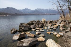
Tenninkyo Onsen — The Quiet Alternative
Most visitors to Daisetsuzan don’t make it to Tenninkyo, and that’s exactly why it’s worth mentioning. This small onsen area sits in a gorge about 30 minutes south of Asahidake, and it has a fraction of the visitors that Sounkyo gets.
Hagoromo Falls here drops 270 meters — taller than both the Sounkyo waterfalls — and there’s a short trail through the gorge that passes columnar basalt formations. The onsen here is smaller and quieter, and if you want the mountain hot spring experience without the tour buses, this is it.
How to Get There
Daisetsuzan doesn’t have a single entrance point — it’s a massive park with multiple access areas. The two main gateways are Sounkyo (east side) and Asahidake Onsen (west side), and they’re actually quite far apart by road (about 2.5 hours driving around the outside of the park).
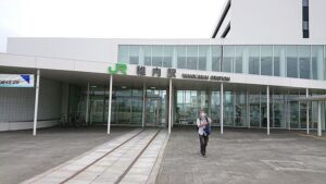
From Asahikawa
Asahikawa is the closest major city and the most practical base. It’s about 65km to Asahidake Onsen (roughly 1 hour by car) or 90 minutes to Sounkyo. Direct buses run from Asahikawa Station to Sounkyo in about 2 hours. For Asahidake, buses run during summer and autumn but service is limited — a rental car gives you much more flexibility.
From Sapporo
Take the Lilac-Kamui Limited Express from Sapporo Station to Asahikawa — about 90 minutes, covered by the Hokkaido Rail Pass. From there, transfer to a bus or rental car. The total journey from Sapporo to Sounkyo is about 3.5 to 4 hours by public transport, or 2.5 hours if you drive directly.
Getting Around the Park
Unless you’re doing the Grand Traverse on foot, a car is strongly recommended. Public buses exist but run infrequently and stop early. If you’re based in Sounkyo, you can walk to the Kurodake Ropeway and the town is small enough to navigate on foot. But reaching the waterfalls and trailheads without a car means taxi rides or long walks along the highway. For renting a car in Hokkaido, book early in autumn — everyone else has the same idea.
Where to Stay
Asahidake Side
The Asahidake Onsen area has a handful of hotels and ryokans clustered near the ropeway base station. This is the quieter, more atmospheric side. Accommodation here tends to be smaller and more traditional — think mountain lodges with onsen baths and kaiseki dinners. It’s also closer to the best hiking. The downside: fewer dining options outside your hotel, and limited evening entertainment (which, depending on your point of view, might actually be an upside).
Sounkyo Side
Sounkyo has more rooms but less character. The big hotels here cater to tour groups and offer all-inclusive stays with onsen, dinner, and breakfast. The plus side is convenience — you walk out of your hotel and you’re at the Kurodake Ropeway within minutes. Prices are generally reasonable for what you get, especially midweek. The minus side is that the town itself doesn’t have much going on once the sun goes down. A couple of ramen shops, a souvenir store, the public bath, and that’s about it.
Asahikawa as a Base
If you don’t want to stay in the mountains, Asahikawa makes a solid base. It’s a proper city with real restaurants, good hotels, and a JR station. You sacrifice the mountain atmosphere and add driving time, but you gain flexibility and comfort. This works especially well if you’re combining Daisetsuzan with eastern Hokkaido or heading to Biei and Furano.
Practical Details
| Detail | Info |
|---|---|
| Park entrance fee | Free (no fee to enter the national park) |
| Asahidake Ropeway round trip | ~¥3,200 adults |
| Kurodake Ropeway round trip | ~¥2,600 adults |
| Kurodake Chairlift round trip | ~¥800 extra |
| Best season for hiking | Late June to September |
| Best for autumn foliage | Late August (summits) to mid-October (gorge) |
| Sounkyo Ice Festival | Late January to mid-March |
| Drive from Asahikawa | ~1 hour to Asahidake, ~1.5 hours to Sounkyo |
| Drive from Sapporo | ~2.5 hours to Sounkyo direct |
Cell phone reception is spotty above the treeline and nonexistent in some of the gorge sections. Download offline maps before you go. The best time to visit Hokkaido overall depends on what you’re after, but for Daisetsuzan specifically, September is the sweet spot — autumn color at the peaks, decent weather for hiking, and the summer crowds have thinned.
There are bear safety signs throughout the park and they’re not decorative. Brown bears live here. Carry a bell, make noise on the trail, and don’t leave food out. Bear encounters are rare but they do happen, especially in autumn when the bears are feeding heavily before winter. The general Hokkaido activity guide covers wildlife safety in more detail.
For photography, the Sugatami area at Asahidake is hard to beat — volcanic steam, autumn color, and mountain peaks in one frame. The observation deck at Ginga/Ryusei waterfalls is another reliable spot. Golden hour in the gorge is limited because the cliffs block low sun, so midday actually works better than you’d expect for the waterfall shots.
Daisetsuzan doesn’t get the press that Furano’s lavender fields or Niseko’s ski slopes do, and I think that’s part of what makes it special. It’s Hokkaido at its most raw — big mountains, real wilderness, no pretense. Just don’t underestimate the weather, bring proper gear, and give yourself enough time. A half-day visit barely scratches the surface. Two or three days lets you actually feel the scale of the place.