This article contains affiliate links. If you book through them, I earn a small commission at no extra cost to you.
In This Article
- Mt. Asahidake — The One You Have to Do
- The Daisetsuzan Grand Traverse — For Serious Hikers Only
- The Asahidake to Kurodake Traverse — The One-Day Alternative
- Mt. Tarumae — The Best Beginner Volcano Hike
- Shiretoko Five Lakes — Wilderness Walking in Bear Country
- Mt. Yotei — Hokkaido’s Mt. Fuji (But Harder)
- Rebun Island — Flower Trails Above the Sea
- Shakotan Peninsula — Coastal Walks Without the Crowds
- When to Go: A Month-by-Month Breakdown
- Bear Safety — Don’t Skip This Section
- What to Bring
- Getting to the Trails
- Quick Trail Comparison
I got lost on Mt. Asahidake. Not dangerously lost — more like “the fog rolled in, the trail markers vanished, and I spent 20 minutes standing in a sulfur field wondering if I’d wandered onto the moon” kind of lost. That was three summers ago, and it’s still the best day of hiking I’ve had anywhere in Japan.
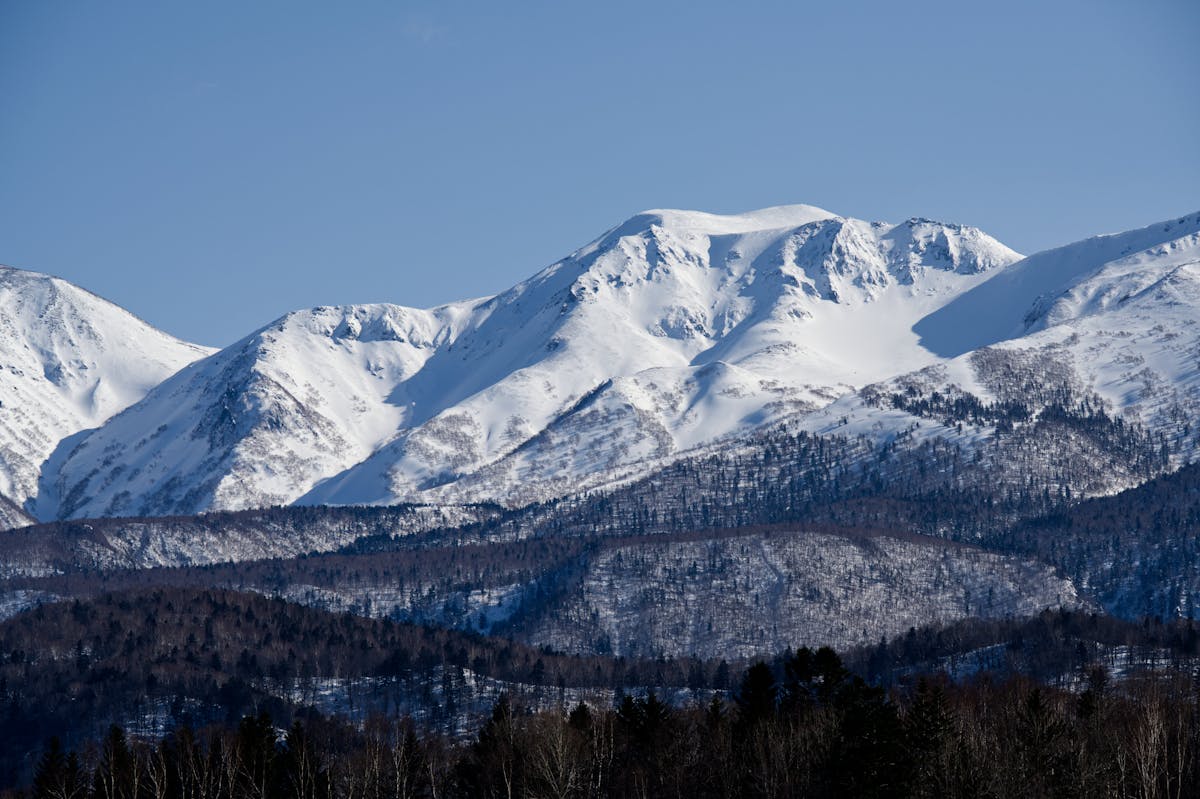
Hokkaido doesn’t get nearly enough credit as a hiking destination. Everyone talks about the Japanese Alps in Nagano or the Kumano Kodo pilgrimage routes, but Hokkaido has something those places don’t: space. Real, honest-to-god emptiness. You can hike for hours and not see another person. The mountains top out around 2,290m, which sounds modest until you realize the treeline sits at just 1,500m here — so you’re above it quickly, walking through alpine flower fields with views in every direction.

The hiking season is short, though. Brutally short. You’ve got roughly mid-July through late September for the high mountains, with some lower trails accessible from May. Snow lingers on the peaks well into July most years, and the first dustings return by early October. The upside? The weather during those summer months is genuinely comfortable — temperatures between 15-25°C in the lowlands, cooler up high — while the rest of Japan melts in 35°C humidity.
Here’s what I’ve learned from hiking across this island over multiple trips: which trails are worth planning your entire trip around, which ones you can skip, and the practical stuff that nobody tells you until you’re already standing at the trailhead.
Mt. Asahidake — The One You Have to Do
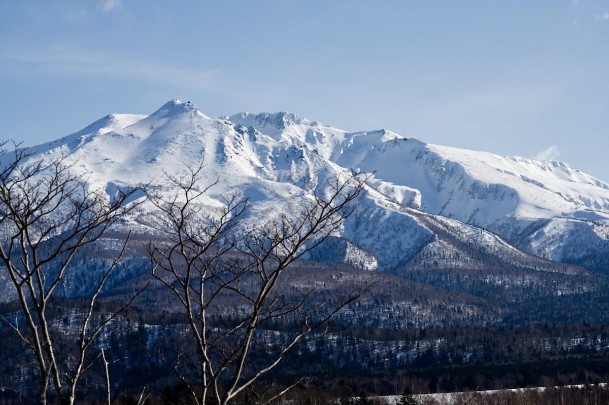
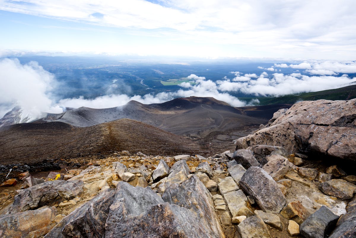
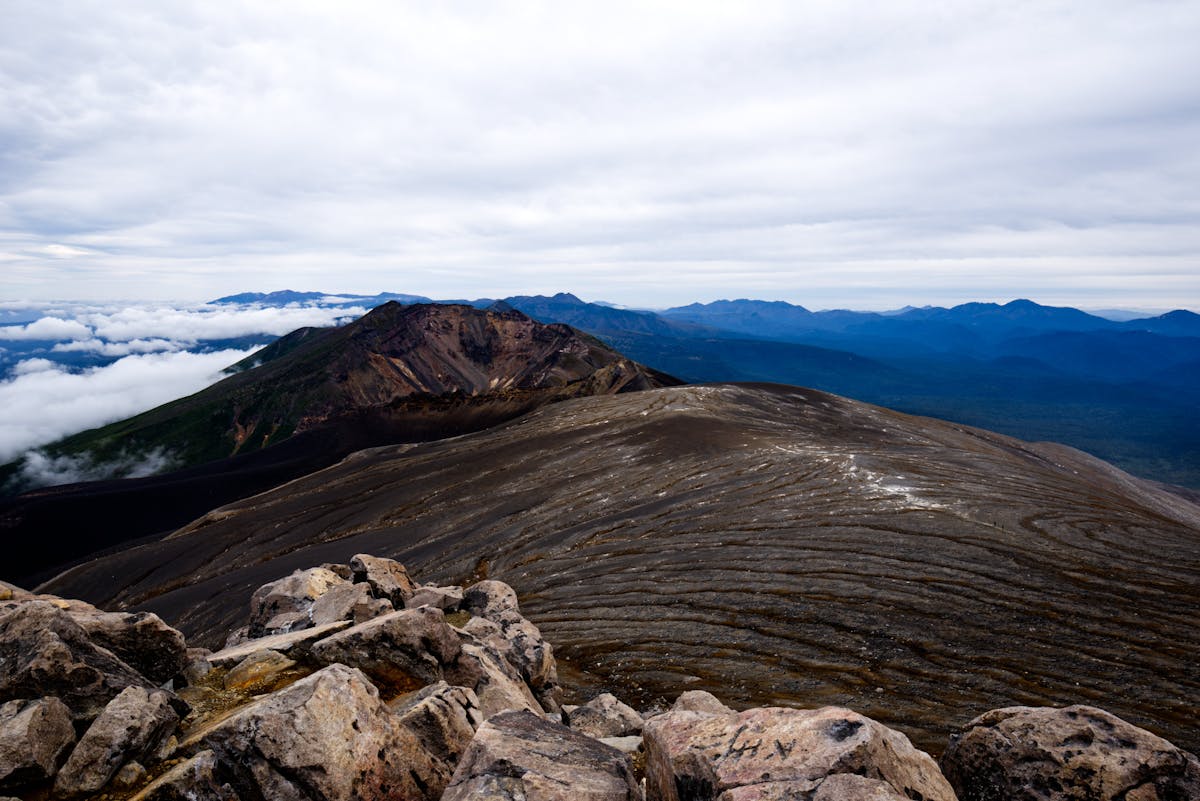
At 2,291m, Asahidake is Hokkaido’s tallest peak, sitting inside Daisetsuzan National Park. But here’s what makes it special: the Asahidake Ropeway hauls you up to 1,600m, so you’re already above the treeline before you take your first step. The summit push from there takes about 4-5 hours round trip, depending on your pace and how long you stand around gawking at the fumaroles.
The trail passes through Susoai-daira, a high plateau covered in alpine wildflowers from mid-July through August. White cotton-like Aleutian avens, purple bellflowers, the whole spread. Then it gets steeper, rockier, and the views open up over what the Ainu people called Kamui Mintara — “the playground of the gods.” On a clear day you can see all the way to the Tokachi mountain range.
Even if you don’t want to summit, take the ropeway up and do the Sugatami Pond Loop — it’s about 1.6km, mostly flat, and puts you right next to hissing volcanic vents and reflecting pools. Every able-bodied visitor does this one, and honestly, it’s the most dramatic short walk I’ve done in Japan.
Difficulty: Moderate (summit), Easy (pond loop)
Distance: ~6km round trip to summit from ropeway top station
Time: 4-5 hours (summit round trip), 30-45 minutes (pond loop)
Ropeway cost: ¥2,200 round trip
Access: Bus from Asahikawa Station (Ideyu-go bus, ~1.5 hours, ¥1,430)
Best months: Mid-July to September
Note: Check bear sighting reports at the visitor center before heading out
If you’re planning around this, my Hokkaido summer guide covers what else to do during the hiking season.
The Daisetsuzan Grand Traverse — For Serious Hikers Only
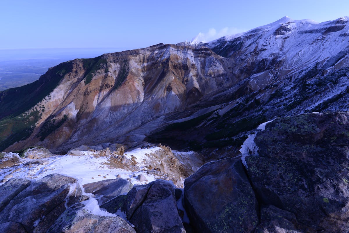
This is the big one. The multi-day traverse from Mt. Asahidake to Mt. Tomuraushi (or sometimes extended to Mt. Tokachidake) is considered one of Japan’s greatest hikes. And it’s earned. You’re walking across the roof of Hokkaido, above the treeline for most of it, through volcanic landscapes that genuinely look alien.
The standard Asahidake-to-Tomuraushi route takes 2-3 days and covers roughly 30-40km depending on your exact path. There are mountain huts along the way — basic ones, not staffed lodges like in the Alps — so you need to carry your own food and sleeping gear. The huts operate on a first-come, first-served basis, and during peak season (late July to mid-August) they fill up. Bringing a tent as backup isn’t paranoid, it’s smart.
I’ll be honest: this one requires proper preparation. Navigation can be tricky in fog (ask me how I know), the weather turns fast, and there are brown bears throughout the park. But if you’re an experienced hiker looking for something genuinely remote and wild in Japan, this is it. Nothing on Honshu comes close to this level of backcountry solitude.
Getting to the start is straightforward enough from Asahikawa via the JR line, but the exit at Tomuraushi is remote. Most hikers arrange transport back to Asahikawa or Obihiro in advance. A rental car makes the logistics much easier — Hokkaido car rental starts from about ¥4,000-6,000 per day, and you can compare prices through our road trip guide.
The Asahidake to Kurodake Traverse — The One-Day Alternative
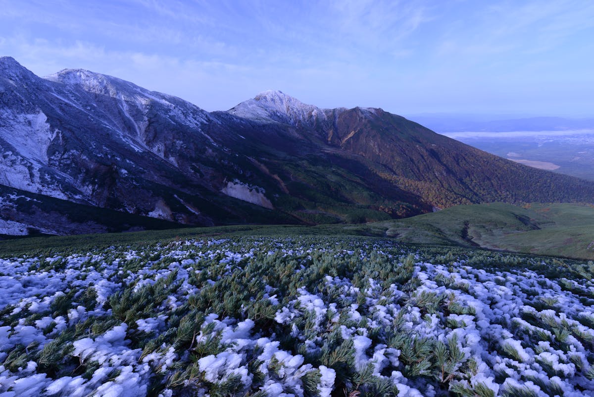
Can’t commit to the full multi-day traverse? This day hike version gives you a taste. It’s roughly 10km from the top of the Asahidake Ropeway to the Kurodake Ropeway at Sounkyo Onsen, crossing the high plateau between the two peaks. You’ll pass Nakadake Onsen along the way — a natural hot spring sitting in a rocky gorge at 1,830m, where volcanic heat warms the pools directly. Soaking in that after hours of walking? Unreal.
The traverse takes 6-8 hours and crosses alpine meadows, lingering snow patches (even in August), and tunnels of dwarf Siberian pine called Haimatsu. The elevation gain is moderate — around 320m — but the distance and terrain make it a full day.
End the day at Sounkyo Onsen, a hot spring town carved into a narrow gorge. The town itself is nothing special — a string of hotels along a road — but the gorge scenery is dramatic and you can soak your wrecked legs in proper onsen water. Check my Hokkaido onsen guide for more options across the island.
Mt. Tarumae — The Best Beginner Volcano Hike
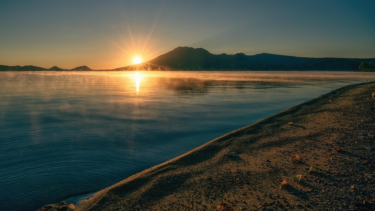
If you only have time for one easy hike near Sapporo, make it Tarumae. This active volcano sits on the south shore of Lake Shikotsu, about 90 minutes by car from the city. The hike from the seventh station car park to the crater rim takes just 40-50 minutes, and what you get at the top is completely out of proportion to the effort: a steaming lava dome, views over Lake Shikotsu to one side and the Pacific Ocean to the other, and the sulfurous smell of an active volcanic system.
The trail is well-maintained and manageable for anyone with basic fitness. You can walk the full crater rim in about 2-3 hours total. The only catch? The road to the seventh station typically opens in late May or early June and closes in November, depending on snow conditions.
One thing nobody mentions: the parking lot fills up fast on weekends in summer. Get there before 8am if you can. And the wind at the crater rim is brutal — bring a windbreaker even if it looks calm at the base.
Difficulty: Easy to moderate
Distance: ~4km (crater rim circuit)
Time: 2-3 hours total
Access: Car only — 90 minutes from Sapporo, near Lake Shikotsu. No public bus to the trailhead.
Best months: June to October
Elevation: 1,041m (starting from 7th station at ~700m)
Warning: Active volcano — stay on marked trails. The lava dome area is off-limits.
Shiretoko Five Lakes — Wilderness Walking in Bear Country
Shiretoko Peninsula is a UNESCO World Heritage Site on Hokkaido’s northeast coast, and it’s one of the most concentrated areas for brown bears in Japan. The Five Lakes (Shiretoko Goko) walk is the most popular way to experience it without needing mountaineering skills or bear spray certification.
There are two routes: an elevated wooden boardwalk (free, open to anyone, 800m loop) and the ground-level trail that loops all five lakes (about 3km, 90 minutes). The ground trail is the one you want — it winds through virgin forest with views of the Shiretoko mountain range reflected in the lakes. But here’s the thing: from May to late July, you can only walk the ground trail with a certified guide due to bear activity. That costs about ¥5,000-5,500 per person. From August through October, you can walk it independently after completing a free 10-minute bear safety lecture.
Is it worth the guided fee? Honestly, yes. The guides know where the bears have been spotted, point out things you’d miss (eagle nests, deer tracks, fox dens), and it’s a more relaxed experience knowing someone professional is watching for wildlife. But if you’re on a tight budget and visiting in August or later, the self-guided option is perfectly fine.
Shiretoko is remote — it’s a solid 5-6 hour drive from Sapporo, or you can fly to Memanbetsu Airport and drive from there. I covered the full logistics in my eastern Hokkaido guide.
Mt. Yotei — Hokkaido’s Mt. Fuji (But Harder)
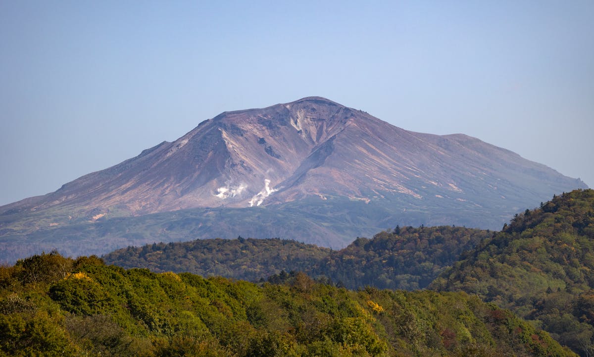
Everyone calls Mt. Yotei “Hokkaido’s Mt. Fuji” because of its symmetrical volcanic cone shape. Fair enough — it looks stunning from Niseko and the surrounding flatlands. But climbing it is a completely different story from Fuji. Yotei is steeper, less developed, has no mountain huts or vending machines along the way, and takes 8-10 hours round trip from the Hirafu trailhead.
At 1,898m, Yotei is a serious day hike. The trail gains about 1,500m of elevation from base to summit, most of it through dense forest before breaking out above the treeline into loose volcanic scree. The reward at the top is a massive crater with a pond inside, plus 360-degree views on clear days. But clear days at the summit are rare — Yotei makes its own weather, and you might spend 10 hours climbing only to reach a whiteout.
I’ll be straight: unless you’re fit and experienced, skip Yotei. It’s the kind of hike where people regularly underestimate the difficulty and end up getting rescued. If you do go, start before dawn (5am or earlier), bring more water than you think you need, and check the weather forecast obsessively. The main trailhead is at Yotei Tozan-guchi near Kutchan — accessible by car from Niseko in about 15 minutes.
If you’re in the Niseko area but want something less punishing, the area has plenty of easier walking options. My things to do guide covers outdoor activities across the island.
Rebun Island — Flower Trails Above the Sea
Rebun Island is about as far north as you can go in Japan and still be on marked hiking trails. It’s a narrow sliver of land off Hokkaido’s northwest coast, famous for its alpine wildflowers that grow at sea level — something you won’t find anywhere else in Japan. Over 300 species of flowers bloom here between June and August.
The main hike is the 8-Hour Course (yes, that’s the actual name), which runs roughly 25km along the island’s west coast from Cape Sukoton at the north end to Motochi in the south. Despite the name, most hikers finish in 6-7 hours. The trail follows the coastline, crossing flower-filled meadows on clifftops with the sea below and views of Mt. Rishiri’s volcanic cone across the water. It’s not steep — the whole island barely tops 490m — but the distance and wind make it tiring.
There’s also a shorter 4-Hour Course covering the northern half if a full day feels like too much. Both trails are well-marked. The main difficulty is weather — Rebun gets fog and wind regularly, and there’s no shelter for long stretches. Bring rain gear regardless of the forecast.
Getting to Rebun requires a ferry from Wakkanai (about 2 hours). I covered the whole northern tip of Hokkaido including ferry details in my Wakkanai and northern Hokkaido guide.
Shakotan Peninsula — Coastal Walks Without the Crowds
Shakotan is the one I recommend for people who want an easy, scenic half-day hike close to Sapporo. The peninsula juts out into the Sea of Japan about 2 hours west of the city, past Otaru, and the coastline is genuinely striking — turquoise water, jagged cliffs, and almost nobody around once you leave the car parks.
The main walk is the trail from the Shimamui Coast parking area out to the rocky beach and sea caves. It’s short — maybe 30 minutes each way — but the water color is absurd. Seriously, it looks tropical except it’s 15°C. There’s also the walk out to Cape Kamui, which takes about 20 minutes along a cliffside path to a lighthouse at the tip. The views from there stretch in every direction.
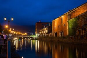
Neither of these qualifies as serious hiking, but combined with a Hokkaido road trip and a stop in Furano and Biei or Lake Shikotsu, Shakotan makes for a brilliant day out. Stop in Otaru on the way back for sushi — the canal town is worth a few hours on its own.
When to Go: A Month-by-Month Breakdown

Here’s the honest assessment of each month. I’m not going to pretend April is a good time for hiking just to fill out the calendar.
May: Low-altitude trails only. Lake Shikotsu area, some Sapporo city mountains. Roads to most mountain trailheads are still buried in snow. The cherry blossoms are nice if you’re around — Hokkaido’s bloom happens in early May, weeks after the rest of Japan.
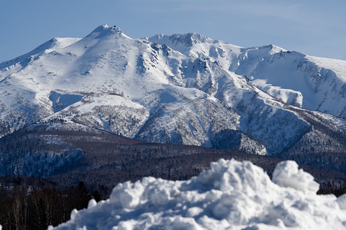
June: Getting better. Mt. Tarumae road usually opens. Lower mountain trails in Shikotsu-Toya National Park are good. Rebun Island flowers start blooming. But the high mountains in Daisetsuzan still have heavy snow. June also brings some rain, though nothing like the monsoon that hammers Honshu.
July (second half): This is when it really kicks off. The Asahidake Ropeway opens, high-altitude trails become passable, and the alpine flowers peak. Expect lingering snow patches even in late July. This is peak season for serious mountain hiking. Bear activity is also at its highest — more on that below.
August: Prime time. The warmest, driest month. All trails are open, snow has mostly retreated, and wildflowers are still going. The downside: it’s also the busiest month, though “busy” in Hokkaido means you might see 30 people on a major trail instead of 3. Compared to trails on Honshu, it’s still empty.
September: My personal favorite. The autumn colors start in the high mountains around mid-September — Daisetsuzan is one of the first places in Japan to turn. Fewer hikers, cooler temperatures, clear skies. By late September the colors are peaking at higher elevations and the lower forests are just starting to change.
October: The window is closing fast. First snow hits the high peaks in early to mid-October. Lower trails still work for the first half of the month. The autumn foliage moves down to the valleys and cities. But be prepared for cold — mountain temperatures can drop below freezing. My Hokkaido autumn guide covers the best foliage spots.
For a broader view of when to visit for any activity, check the best time to visit Hokkaido guide.
Bear Safety — Don’t Skip This Section
Hokkaido has brown bears. Lots of them — around 12,000 at last estimate, and the population has been growing. Bear encounters on hiking trails happen every year, and they’ve become more frequent recently. This isn’t a reason to skip hiking in Hokkaido, but it’s a reason to take precautions seriously.
The basic rules:
Carry a bear bell. Those small brass bells you clip to your pack aren’t a tourist gimmick — they work by alerting bears to your presence so they move away before you get close. Most encounters happen when hikers surprise bears. You can buy them at any outdoor shop in Hokkaido for ¥500-1,500, or at convenience stores near popular trailheads.
Make noise in dense forest sections. Talk, clap, sing — whatever. Bear bells help, but in thick vegetation or near rivers where running water drowns out sound, extra noise matters. Solo hikers are at higher risk because they’re quieter.
Check the visitor center for recent sightings. Trail closures happen regularly when bears are spotted. The visitor centers at Asahidake, Sounkyo, and Shiretoko all maintain sighting maps. Take 5 minutes to check before you start walking.
Don’t hike at dawn or dusk. Bears are most active in the early morning and evening. Starting your hike at 8-9am and finishing by 4pm keeps you in the lower-risk window.
Food management. Don’t leave food unattended. If camping, hang your food or use bear-proof containers. Bears have excellent noses and will investigate food smells from a long distance.
Bear spray is available in some outdoor shops, but it’s not commonly sold in Japan. Most Japanese hikers rely on bells and noise rather than spray. Your call on whether to bring your own — just check airline regulations for transporting pressurized containers.
What to Bring
Packing for Hokkaido hiking isn’t complicated, but a few things catch people off guard. For a detailed packing list covering all seasons, see my Hokkaido packing list guide.
For summer hiking specifically:
Layers. Valley temperatures might be 25°C, but the summit of Asahidake can be 8°C with wind chill. A lightweight fleece or down jacket is non-negotiable for anything above the treeline. I’ve seen people at the Asahidake ropeway station in t-shirts and sandals — they turned around at the top within minutes.
Rain gear. Hokkaido’s summer weather changes fast. A packable rain jacket at minimum. Waterproof pants if you’re doing multi-day routes or anything on Rebun Island where the wind drives rain sideways.
Proper footwear. For short trails like Tarumae or Shakotan, sturdy trail shoes work. For Daisetsuzan or Yotei, you want ankle-high hiking boots. The terrain above treeline is loose volcanic rock and scree — rolled ankles are common.
Water. There are no water stations on mountain trails. Carry at least 1.5L for day hikes, more for longer routes. Some huts have water, but boil or filter it. Vending machines exist at ropeway stations but nowhere else once you’re on the trail.
Sun protection. The UV is surprisingly strong at altitude in Hokkaido, and there’s no tree cover above the treeline. Sunscreen, hat, sunglasses.
Bear bell. Already mentioned it, mentioning it again. ¥500 at the nearest convenience store. Just buy one.
Getting to the Trails
This is the part where Hokkaido hiking gets tricky. Unlike Honshu where dense train networks put you at most trailheads within a reasonable walk, Hokkaido’s mountains are spread out and public transport is thin.
Renting a car is the single best thing you can do for hiking in Hokkaido. Full stop. It opens up every trailhead, lets you start early before the crowds, and some places — like Mt. Tarumae, Shakotan, and many Daisetsuzan access points — simply have no bus service. Car rental runs from about ¥4,000-6,000 per day, and you can get them at New Chitose Airport or Sapporo. Driving in Hokkaido is easy — wide roads, light traffic outside Sapporo, and GPS navigation works fine in English.
Public transport works for some routes but requires planning. The Ideyu-go bus from Asahikawa to Asahidake Onsen runs during hiking season (about 1.5 hours, ¥1,430). Sounkyo Onsen has bus connections from Kamikawa or Asahikawa. But connections are infrequent — miss one bus and you might wait 3-4 hours for the next. The JR Pass gets you between cities, but the last mile to trailheads is almost always a bus or taxi.
Hitchhiking is legal in Japan and surprisingly effective in Hokkaido, where drivers are friendly and used to seeing hikers. It’s not something I’d bank an itinerary on, but it works as a backup. Just be respectful about where you stand — blocking traffic can get you in trouble.
For a full breakdown of Hokkaido transport options including car rental tips, see the Hokkaido road trip guide.
Quick Trail Comparison
| Trail | Difficulty | Time | Best For | Season |
|---|---|---|---|---|
| Mt. Asahidake (summit) | Moderate | 4-5 hrs | Best all-round alpine hike | Jul-Sep |
| Sugatami Pond Loop | Easy | 30-45 min | Quick volcanic scenery | Jul-Sep |
| Daisetsuzan Grand Traverse | Hard | 2-3 days | Serious multi-day backcountry | Late Jul-Sep |
| Asahidake-Kurodake | Moderate-Hard | 6-8 hrs | Day-hike traverse with onsen | Jul-Sep |
| Mt. Tarumae | Easy | 2-3 hrs | Beginners, families, quick volcano hike | Jun-Oct |
| Shiretoko Five Lakes | Easy | 1.5-2 hrs | Wildlife, UNESCO scenery | May-Oct |
| Mt. Yotei | Hard | 8-10 hrs | Experienced hikers only | Jul-Sep |
| Rebun 8-Hour Course | Moderate | 6-7 hrs | Wildflowers and coastal scenery | Jun-Aug |
| Shakotan (Shimamui + Cape Kamui) | Easy | 1-2 hrs | Quick coastal walk, road trip stop | May-Oct |
So there it is. Hokkaido won’t give you the Instagram-famous trails or the social media hype of other Japanese hiking destinations. What it gives you is something better: real mountains, real wilderness, and the feeling of being somewhere that most tourists never bother to reach. Start with Asahidake, work your way out from there, and carry a bear bell. You’ll be fine.